
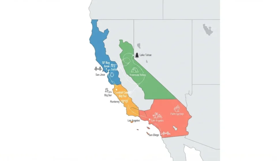
The best places to visit in California span four regions: San Francisco and the Bay Area, Yosemite and the Sierra Nevada, the Central Coast including Big Sur, and Southern California from Los Angeles to San Diego. Each region needs at least three to four days to see properly, so most first-time visitors pick two or three regions rather than trying to cover the whole state.
Why Region Matters More Than A Single List
California is roughly 770 miles from top to bottom, longer than the distance from London to Rome. Treating it as one destination leads to the common mistake of trying to see Yosemite, San Francisco, and San Diego in a single week, which turns most of the trip into driving. Picking a region, or two adjacent ones connected by a reasonable drive, gives you time to actually be somewhere instead of just passing through it.
San Francisco And The Bay Area
Plan on three to four days here. San Francisco itself covers the Golden Gate Bridge, cable cars up the city’s steep hills, and neighborhoods like the Mission District and North Beach that each feel like a different city. Alcatraz Island tours sell out weeks in advance, so book that before anything else on the itinerary.
Beyond the city, Napa and Sonoma sit about an hour north and cover the state’s best-known wine country, with hundreds of wineries ranging from small family operations to large estates with vintage train tours. Point Reyes National Seashore, less than two hours from the city, is a quieter alternative for coastal hiking and wildlife, including elephant seals and, from January through April, migrating grey whales offshore.
Best time to visit: September and October give the warmest, driest weather, since San Francisco’s summer is famously cool and foggy.
Yosemite And The Sierra Nevada
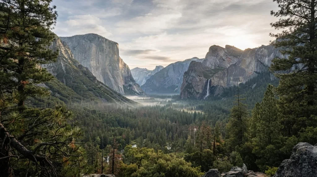
Plan on three to four days minimum, more if you want to add Sequoia or Kings Canyon nearby. Yosemite Valley is the park’s core, with El Capitan and Half Dome as the two landmarks most people come to see, plus Yosemite Falls, one of the tallest waterfalls in North America. Tunnel View and Glacier Point are the two overlooks worth prioritizing if your time is limited, both looking straight down the valley toward Half Dome.
Sequoia National Park, about three and a half hours south of Yosemite, holds General Sherman, the largest tree on Earth by volume, inside its Giant Forest. Visiting in early winter has a real upside: crowds thin out dramatically, and it’s possible to have entire groves to yourself.
Best time to visit: late spring, when waterfalls run at full force from snowmelt, or September for fewer crowds and still-pleasant hiking weather. Summer sees the heaviest visitation of the year.
The Central Coast And Big Sur
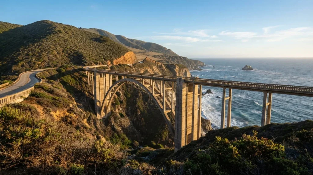
Plan on one to two days for the drive itself, three to four if you want time to hike and stop properly. The stretch of Highway 1 between Monterey and San Simeon is consistently ranked among the most scenic drives in the country, running along cliffs that drop more than 1,000 feet to the Pacific. McWay Falls, an 80-foot waterfall that empties directly onto a beach, is the single most photographed stop along the route.
Carmel-by-the-Sea, just south of Monterey, packs more restaurants per square mile than almost any small town in the country into a one-square-mile footprint, and it’s walkable enough to explore without a car once you’ve parked. Cell service disappears for long stretches through Big Sur, and gas stations are scarce for more than 70 miles, so fill up and download any maps before starting the drive.
Best time to visit: April, May, September, or October, when fog is lightest and temperatures stay mild in both directions.
Southern California, From Los Angeles To San Diego
Plan on four to five days to cover this region properly, since it spans several distinct destinations rather than one city. Los Angeles offers the Hollywood sign, the Getty Center, and beach towns like Santa Monica and Venice Beach that each have a different personality despite sitting minutes apart. Traffic is the region’s defining constraint, so building buffer time into any drive across the city saves real frustration.
San Diego, about two hours south, trades LA’s sprawl for a more compact, walkable core, with Balboa Park, the San Diego Zoo, and beaches like La Jolla and Coronado within a short drive of downtown. Palm Springs, roughly two hours east of LA, adds a desert counterpoint with retro-modern hotels and easy access to Joshua Tree National Park for rock climbing and stargazing.
Best time to visit: March through May or September through November. Summer brings heavy crowds to beaches and desert heat that regularly passes 110°F in Palm Springs and Joshua Tree.
Death Valley, for a different kind of California
Death Valley National Park deserves its own mention since it doesn’t fit neatly into any of the four regions above, sitting roughly four hours from both Los Angeles and Las Vegas. Badwater Basin, the lowest point in North America at 282 feet below sea level, and Zabriskie Point, best seen at sunrise for its colorful badlands, are the two stops most worth the detour. Entry runs $30 per vehicle for a seven-day pass.
Visit only between November and March. Summer temperatures regularly exceed 120°F and have caused fatalities among unprepared visitors, which makes this one of the few destinations on this list where timing isn’t just about crowds or weather comfort. It’s a genuine safety issue.
Putting a Trip Together
Most visitors do best picking two adjacent regions rather than attempting all four. San Francisco paired with Yosemite works well by rental car, roughly a four-hour drive apart. Los Angeles paired with San Diego and Palm Springs forms a natural Southern California loop, connecting some of the best cities to visit in the USA. Big Sur bridges the two halves of the state nicely if you’re flying into one region and out of another, since it sits almost exactly between San Francisco and Los Angeles along the coast.
Renting a car is close to essential outside the cities themselves. Amtrak’s Pacific Surfliner connects San Diego, Los Angeles, and Santa Barbara for travelers who’d rather skip driving on that specific stretch, but the mountain and coastal regions have no comparable rail option.
FAQ’S
How many days do you need to see the best of California?
Ten to fourteen days lets you cover two regions properly, such as San Francisco and Yosemite, or Los Angeles, San Diego, and Palm Springs together. A week is enough for one region if you’re not trying to add long drives on top of it.
What’s the best time of year to visit California overall?
Spring, April and May, and fall, September and October, hit the sweet spot for most of the state: mild temperatures, thinner crowds than summer, and functioning mountain roads that haven’t yet seen winter snow.
Is it better to fly into one city and out of another?
Yes, if your route runs in a rough line, since California allows this at most major airports without a one-way rental fee penalty at some agencies. Flying into San Francisco and out of Los Angeles, for example, avoids backtracking up the coast.
Do you need a car to see California’s best places?
Outside the dense cores of San Francisco, Los Angeles, and San Diego, yes. Yosemite, Big Sur, Napa Valley, and Death Valley have no meaningful public transit connecting them to anywhere else.
What’s the most underrated region compared to the famous spots?
The Central Coast between Big Sur and Santa Barbara gets treated as a driving corridor between LA and San Francisco by most visitors, when towns like San Luis Obispo and Solvang reward an actual overnight stay rather than a quick photo stop.